
College Station Street Directory Workflow
For a College Station street-by-street question, begin with an exact address and keep a short record log. The useful chain is parcel first, owner next, recorded instrument after that, then historical address sources if the question reaches further back. A current owner is not automatically a current resident. The strongest result distinguishes the parcel location, the tax-mail recipient, a deed party, and an address listing instead of treating those labels as interchangeable.
Use the public sources in sequence. The College Station city map gives context around a location, while the county appraisal card supplies property identifiers that make the County Clerk index more precise. Voter status and election materials have separate access rules, and the public lookup is not a street-browse roster. College Station historical street sections can help establish an older household, but they are leads that need confirmation from a dated record.
- Search the address in Brazos Central Appraisal District and save the situs address, property or geographic ID, subdivision, lot or block, and legal description.
- Open the College Station map, turn on parcel and boundary context, and note the subject parcel and the visible lots along the same street.
- Compare the city parcel result with the CAD mailing address. Keep each as a separate fact rather than calling either one proof of occupancy.
- Search the current owner as grantee in the County Clerk’s deed index, then use the seller or earlier instrument as the backward link.
- For an older household question, ask the Carnegie History Center or Texas A&M Cushing collections for the relevant street directory volume, then compare that entry with a deed, census, or obituary.
Note: A street result becomes more reliable when the search log preserves the source, date, parcel ID, and whether each name is an owner, a mail recipient, or an address lead.
College Station Street Directory CAD Search
The Brazos CAD property search is the practical starting point for College Station addresses. Its visible modes are By Owner, ARB Search, and Advanced. Owner searches use the stated format “Last Name First Name.” For a street search, CAD says to leave out the prefix, suffix, and unit number, then try directional variants separately if a result does not appear. This is a parcel search, not a complete household list.
| CAD field | Control | How it helps a street search |
|---|---|---|
| Owner Name | Text | Connects a known owner to a parcel result. |
| Street Number / Street Name | Text | Finds an address while Street Name omits prefix, suffix, and unit. |
| Property ID / Geographic ID | Text | Preserves a stable parcel key for later checks. |
| Subdivision / Neighborhood | Dropdown or autocomplete-style control | Helps compare a development when a street string is incomplete. |
| Tax Year / Property Type | Dropdown or autocomplete-style control | Narrows appraisal records without asserting occupancy. |
CAD’s visible Advanced form also lists Abstract, MobileHomePark, Agent Id, Protest Status, Informal Date, Doing Business As, Condo, Owner ID, Hearing Date, Board Members, and Formal Date alongside the address, owner, property, subdivision, geographic-ID, neighborhood, and tax-year fields. The rendered form did not expose complete dropdown option lists, export behavior, or pagination, so those details should be checked live before depending on a large College Station result set.
A parcel card can expose an owner, mailing address, situs or property address, legal description, values, exemptions, and tax-year history. Mailing address means where notices go. It can belong to an owner elsewhere, an agent, or a postal box. CAD also labels current values as preliminary and cautions that legal descriptions and acreage should be verified, so the County Clerk record remains important for title work.
College Station GIS Street Layers
The College Station maps and GIS hub puts an address in geographic context. Its Planning and Development resources include parcel and subdivision information, zoning, city limits, ETJ, annexation, HOA, and historical imagery resources. Postal labels, city limits, and ETJ lines do not coincide, so a “College Station” mailing line alone should not settle a jurisdiction question.
Use the map by panning to the street, zooming until parcel lines are visible, turning on the needed layers, then clicking the subject parcel and each visible parcel one at a time. The published information supports parcel-by-parcel review. It did not verify an automatic radius, buffer, or adjacency tool, so the careful approach is manual and documented.
See the College Station maps and GIS hub before using its layers.
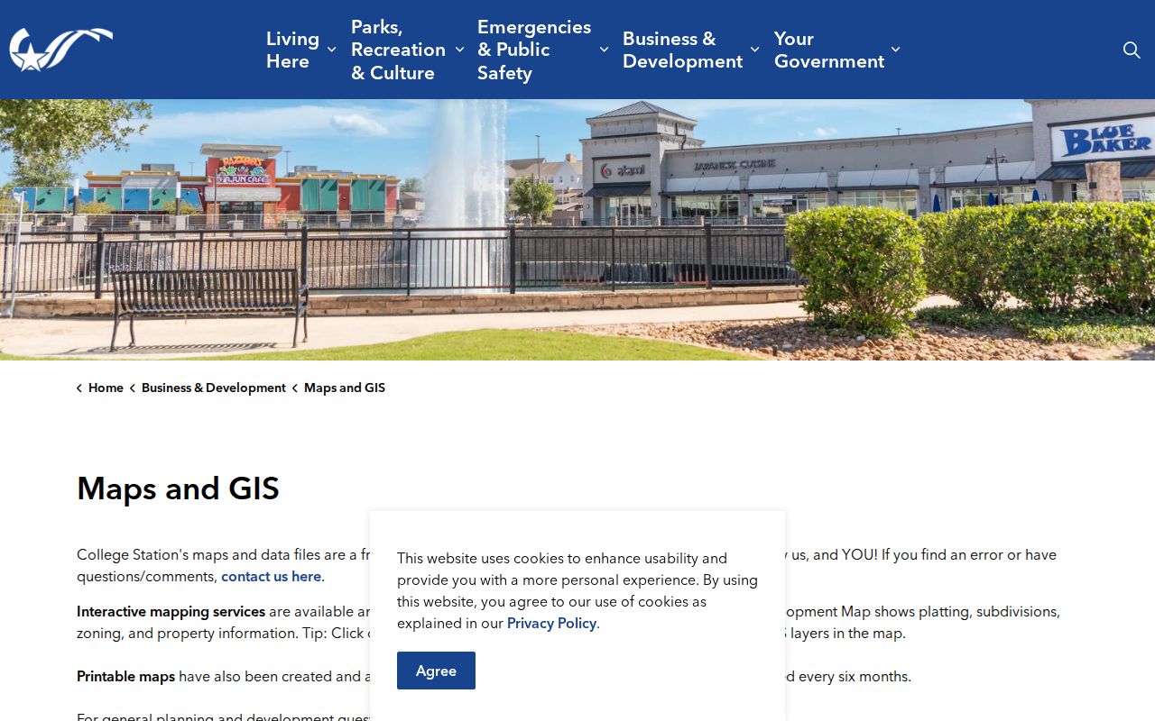
The map layer view is best used to orient a street search, then each parcel identifier can be checked in the city search or CAD rather than assumed from map proximity.
College Station Street Directory Records
Address-keyed sources describe different pieces of the same location. CAD connects an address to an appraisal parcel. The city map gives boundary and subdivision context. The deed index follows parties and legal descriptions. City permit material may date work at a site, while library directories can place a historic name in street order. The table keeps their limits visible.
| Address source | What it can establish | Access and limit |
|---|---|---|
| CAD appraisal record | Owner, mailing and situs addresses, parcel ID, legal description, values, exemptions | Public property search; not a roster of every occupant. |
| City GIS / parcel search | Parcel geometry, street, subdivision, zoning, land-use and boundary context | Map click and parcel tabs; city data carries a no-warranty disclaimer. |
| County deed index | Grantor, grantee, document date and legal description | Person and legal-description search; complete web cutoff is not stated. |
| City permit or code file | Address or parcel, project, inspection, or released case details | Permit route is login-gated; narrow city request may be needed. |
| Directories and newspapers | Historic address sequence and possible former household lead | Carnegie and Texas A&M sources have gaps and omissions. |
For a College Station parcel, the ID and legal description are the useful connectors. A street name can change spelling, use a directional form, or fail to appear in a rural abstract description. When that happens, move from the address string to subdivision, lot, block, plat, or abstract terms before deciding the record is missing.
College Station Street Deed Trail
The Brazos County Official Records Search supplies Quick Search and Advanced Search for grantor or grantee names, subdivision, document type, document number, and paired recorded-date limits. Choose Search Index Only for indexed names and metadata. Index & Full Text uses OCR, which can be useful for a phrase in legal-description text. The portal separates recorded-date and image-date labels.
For a College Station deed trail, start with CAD’s owner and legal description. Search that owner as grantee for a purchase deed, open the image when available, and record the seller, document number, recording date, return address, legal description, and plat reference. Search the seller as grantee to find an earlier acquisition. Trusts, estates, probate, and heirship records may explain a break. County deed records begin in 1841, but the portal does not state its complete earliest searchable web year. The County Clerk lists plain copies at $1 per page and certified instruments at $1 per page plus $5 certification.
Use the Brazos official-records index as the source for the visible Quick and Advanced search controls.
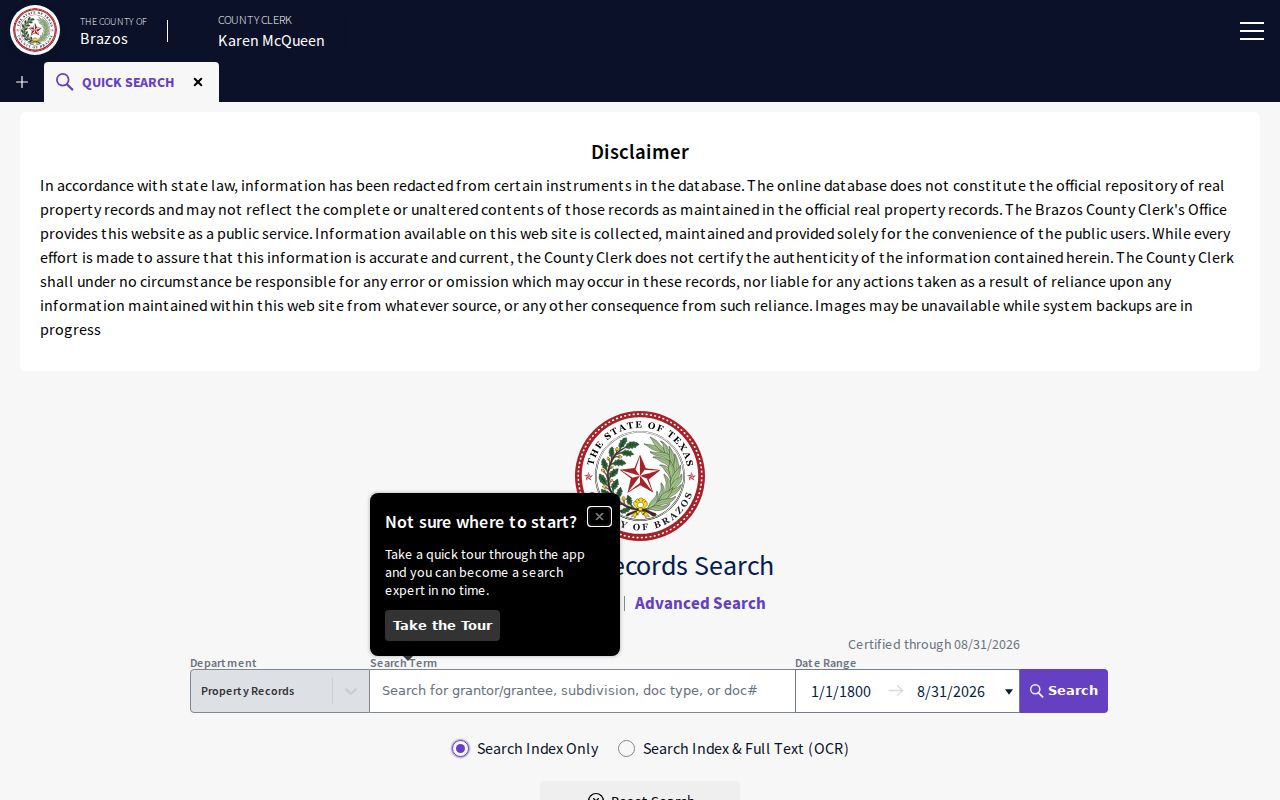
The index can move an address inquiry beyond a street string, but a deed party may be an owner, lender, trustee, or representative rather than a person living at the parcel.
College Station Parcel Details
The city’s parcel search has visible Search By, Search Operator, and Search Value controls, a map control, and a print option. Its result tabs are Parcel Info, Owner Info, Restriction Details, Land Use, Building, Legal Desc, and Inspections. It is a useful city-side bridge when the address needs to be tied to a local parcel view before checking CAD or recorded land instruments.
The College Station permit route currently reaches registered-user login. When a particular permit file or released code case is not visible, request an existing item by address, date range, and record type through the city’s public-records request channel. Texas Public Information Act requests cover existing city-held material, while judicial records follow different custodian rules.
Open the College Station parcel search to see its map control and record tabs.
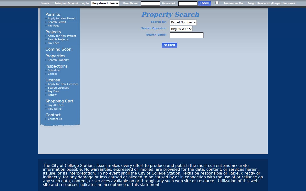
The parcel, owner, legal-description, and inspection tabs show why a parcel number is a better research note than an unverified street-name match.
For map context beyond the parcel card, the city’s open-data service names layers for HOA areas, schools, subdivisions, city limits, land use, ETJ, and zoning. The HOA feature layer uses Registered_Name as its display field. Those layers help identify a geographic setting or an association label; they do not create a list of people associated with a street.
College Station Street Voter Limits
VoteTexas My Voter Portal is built for a name, VUID, or Texas driver’s-license route, not a public browse of every voter on a street. A public match concerns registration or status information. It does not provide ballot choices, and a person who is not returned may have moved, may be protected, or may not be in that search path.
Texas voter-file material has separate request requirements and confidentiality rules. A fuller state request can involve a signed, notarized affidavit, physical-address and identity information, deposit, fee, and Election Code restrictions. Election rosters can give participation, method, and precinct context for a particular election date, not a household list. For an old address lead, Carnegie and Texas A&M reverse directories are the more fitting street tools. The historical shelf itself is described on the College Station city directory page.
Note: Treat a voter result as status evidence for a named person, not as a way to infer every person at a College Station address.
College Station Street Name Changes
A failed College Station historical address search may reflect a changed street form rather than a missing record. A March 23, 1950 Battalion article reports council plans to rename or renumber streets and homes, with proposed forms including Church North Avenue, Foster East Avenue, and Pershing South Avenue. The article documents a proposal only. It does not establish the final adoption or a complete official crosswalk.
Search the old and new stems, directional variants, nearby names, subdivision and lot or block terms. The city’s historical imagery and annexation resources can add geographic context. Early material may use Bryan, rural precinct, campus, or railroad-station descriptions because College Station’s municipal history does not match every older record label. Preserve the original wording in the research log instead of silently converting it to a modern address.
College Station Street Directory Terms
College Station property and deed records use terms that can look alike but answer different questions. Keeping those definitions straight prevents a street directory search from collapsing title evidence into a claim about who lives at a property.
- Parcel
- A defined piece of real property in the appraisal and map system, usually identified by a property or geographic ID.
- Situs address
- The physical location assigned to the property. It differs from the mailing address used for tax correspondence.
- Plat
- A recorded map that ties a subdivision’s lots and blocks to streets and boundaries.
- Criss-cross directory
- A street-order directory section that can place historical entries near an address and its neighbors.
A legal description, such as a lot and block or abstract and league, is the title-side key. It often survives a street renumbering better than a delivery address. CAD cautions that its appraisal legal description and acreage should be verified when precision matters.
College Station Street Directory Limits
A College Station street directory cannot reliably identify every non-owner occupant, boarder, visitor, utility customer, protected voter, or person with a confidential address. Federal law restricts DMV address data. A deed can name a lender, trustee, or representative. A postal ZIP cannot prove city limits or a parcel boundary. Absence from one public source is not evidence that someone never lived there.
Lawful use. College Station address records are for personal, lawful research such as family history, estate questions, and property curiosity. Never use an address trail to stalk, harass, intimidate, or harm anyone.
For a defensible result, record the custodian, date, document or parcel number, and exactly what the source states. That keeps ownership, mailing, and residence evidence in their proper lanes.