
College Station ZIP Code Directory Coverage
Six ZIP designations are associated with College Station in the Texas geographic-code table: 77840, 77841, 77842, 77843, 77844, and 77845. That association is a useful starting point, not a parcel map. Each ZIP may serve a general delivery area, a station or post-office use, an institution, or a mailing route. For a particular address, the Postal Service lookup controls. Keep the ZIP result beside the street address and unit used for the search, especially where a nearby mailing label could look more familiar than the city or county record.
| ZIP | Areas Covered | Post Office | Notes |
|---|---|---|---|
| 77840 | General College Station delivery area and main city postal address | College Station main office, 2130 Harvey Mitchell Pkwy S | Main-office ZIP is 77840-9998; verify each parcel by address. |
| 77841 | Northgate and PO-box-associated College Station mailing | Northgate station, 104 N Houston St | Station ZIP is 77841-9800; confirm delivery type and address. |
| 77842 | College Station postal designation commonly used for PO or mail routing | Exact service boundary not located in an official rendered source | Use Postal Service By Address or By City/State lookup. |
| 77843 | Texas A&M University institutional or unique-use ZIP | Texas A&M physical-address use | 400 Bizzell Street uses 77843; it is not a general city-limit boundary. |
| 77844 | Aggieland station and PO-associated College Station mailing | Aggieland station, 127 Joe Routt Blvd | Station ZIP is 77844-9800; verify delivery type. |
| 77845 | South or suburban College Station postal designation in current code sources | Exact station and city-limit overlap not located | A Postal Service address query controls for a particular address. |
Use the table to decide which ZIP to test, not to draw a line around a property. A full address result may change with a unit, a service type, or the difference between physical delivery and a post-office box. The Texas list establishes a College Station connection for the six codes, while the Postal Service gives the address-level result.
College Station ZIP Code Postal Uses
College Station ZIP codes do not all function alike. The 77843 designation is tied to Texas A&M University use, while 77841 and 77844 have Northgate or Aggieland station and PO-associated notes. The research did not locate an official rendered service boundary for 77842, nor a verified station and city-limit overlap for 77845. State those limits plainly in research notes instead of turning an observed postal association into a boundary claim.
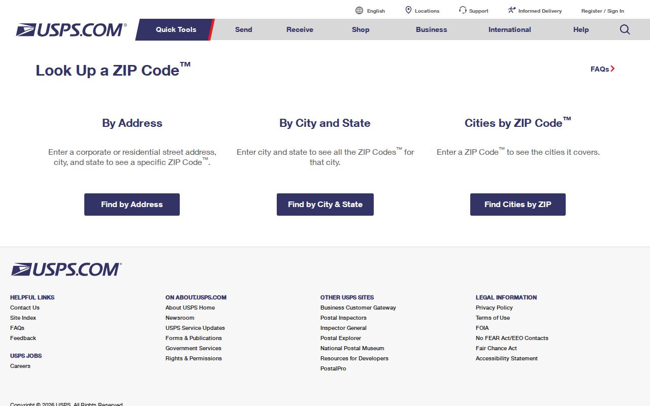
The Postal Service’s By City/State route can start with College Station and Texas, while Cities by ZIP starts with a ZIP. Neither confirms that a named person or company is at an address. The Postal Service warns that multiple matches should be narrowed by unit. That distinction matters when a street has apartments, suites, a campus building, or more than one delivery form.
Note: A ZIP result describes mail routing for the submitted address, not a complete list of residents or a legal parcel description.
Finding Residents by College Station ZIP Code
Start with a complete street address when the goal is to verify a College Station ZIP code. The address result can then be compared with the city parcel map, the Brazos CAD parcel record, and the County Clerk legal description. Each source is keyed differently: a Postal Service address is the delivery key, CAD’s Geographic ID or property ID is the stable appraisal key, and a County Clerk legal description is the title key. This sequence narrows place first and avoids treating a mailing address as proof of physical presence.
- Use the Postal Service By Address lookup with the street address and College Station, Texas. Add the unit when a result is ambiguous.
- Open the City Planning and Development map or parcel search to check the address, subdivision, city limits, and ETJ context.
- Search Brazos CAD by street number and street name, preserving the Geographic ID, situs address, mailing address, and legal description.
- For an ownership question, use the legal description in the County Clerk official-records index rather than relying on the ZIP alone.
- For regulated voter-file fields, use the state request route; the public name lookup is not a browse of everyone in a ZIP.
Once a ZIP result has narrowed an address to a street, the College Station street directory workflow is the place to pursue parcel-by-parcel and street-order records. Postal data is an entry point, not the full address chain.
College Station ZIP Code Lookup Fields
Use the Postal Service form at the level it actually supports. By Address asks for Street Address and City/State, with Company, Apt/Suite, and ZIP available as additional fields. By City/State uses City and State. Cities by ZIP begins with the ZIP. The full address route is the most precise of the three for a delivery question because it allows a unit to resolve a multiple-match result.
| Street Address | Required for the By Address route and should match the delivery location. |
|---|---|
| City and State | Required with an address or used together in the By City/State route. |
| Company | Optional field for an address lookup when it helps distinguish delivery information. |
| Apt/Suite | Optional but important when the Postal Service returns more than one match. |
| ZIP | Optional on By Address and the starting value for Cities by ZIP. |
The Texas voter-file layout also has permanent and mailing ZIP fields, with county, precinct, date, status, and history reductions available through a written state request. It is a bulk route with a signed, notarized affidavit, a deposit, payment conditions, and use restrictions. It is not a free ZIP roster, and protected addresses remain protected.
College Station ZIP Code Parcel Checks
The Brazos CAD form exposes fields such as Street Name, Neighborhood, Subdivision, Geographic ID, and Tax Year, but the reviewed form did not expose a ZIP field. There is no verified CAD ZIP filter. The city parcel search showed Search By, Search Operator, and Search Value, yet no ZIP option was verified there either. Do not promise a whole-ZIP parcel search unless the live portal presents it. Use postal results to identify streets, then run individual addresses or parcels.
The USPS ZIP Code Lookup is the authoritative delivery-address check used for this College Station ZIP code directory.
CAD supplies appraisal data such as owner, mailing address, situs address, Geographic ID, legal description, values, and exemptions. Its mailing address is where tax notices go, not necessarily where the owner lives. City GIS adds city-side geometry, addresses, subdivision, and boundary layers. Comparing the two after a postal lookup keeps a ZIP result from being mistaken for a parcel identity.
Note: The research gap is specific: no CAD ZIP filter and no city parcel-search ZIP option were verified in the inspected interfaces.
College Station ZIP Code and City Limits
A College Station postal label can serve an address outside the incorporated line, and a city parcel can use a Bryan or PO-associated mailing route. City limits, ETJ, postal ZIPs, and CAD parcels are different geographies. The city’s annexation map records approved annexations with ordinance number, date, and approximate extent. Its ETJ layer is planning and regulatory geography, not a ZIP boundary. Use those layers when a city-versus-county label conflict needs to be resolved.
- ZIP versus ZIP+4
- A ZIP identifies a delivery area. ZIP+4 adds a more specific delivery segment, but it does not establish parcel ownership or city limits.
- PO-box ZIP
- A postal code associated with box or station service. It may differ from a physical delivery ZIP.
- Unique ZIP
- A code used for a single organization or institution, such as the Texas A&M-associated 77843 use.
- Carrier route
- A Postal Service delivery grouping used for mail movement, not a municipal boundary.
For an edge address, compare the Postal Service delivery line, city GIS address and parcel, County Clerk legal description, CAD taxing jurisdictions, and annexation history. Normalize directional words and capitalization for searching, but preserve each source’s original string in the notes. School zones and similar public layers can orient a parcel but do not establish ownership or identify all residents.
College Station ZIP Code Routing History
Postal Bulletins in 2015 and 2024 documented routing or label-container changes involving the College Station and Bryan ZIP family, 77840 through 77845. Those notices can explain why a recent mailing label or route description differs from an older one. They are routing history, not evidence that a municipal boundary or property line moved. Use a live Postal Service query and a current city map for a specific address.
College Station’s postal name dates to 1877, after the railroad-station designation, while incorporation came in 1938. That history helps explain older descriptions that may refer to campus, Bryan, a rural area, or the station rather than a modern city form. A March 23, 1950 Battalion item recorded proposed street and home renumbering, including Church North Avenue, Foster East Avenue, and Pershing South Avenue. The research did not locate a complete official crosswalk or final adoption date, so use it as a clue rather than a conversion rule.
College Station ZIP Code Fallbacks
When an online result stops short, move to the custodian that owns the next fact. College Station Planning and Development handles city-limit, ETJ, subdivision, parcel, and addressing questions at 979-764-3570. Brazos CAD can clarify the Geographic ID, appraisal parcel, and tax mailing address at 979-774-4100. The Brazos County Clerk handles legal-description copies at 979-361-4128. A Postal Service station can clarify delivery-address issues, while Carnegie and Texas A&M collections can help decode historic street labels.
Written routes also have a place. A City Secretary public-information request can seek existing addressing, annexation, permit, or departmental material. County Clerk copies can support a legal-description check. The Secretary of State voter request form is the documented route for lawful ZIP or street fields in a bulk file, subject to its affidavit, payment, confidentiality, and use rules. Ask for an existing identifiable record, not a new report assembled from several systems.
Note: Save the date of each ZIP lookup because postal routing labels, CAD values, and online portal behavior can change over time.